|
|
|
|
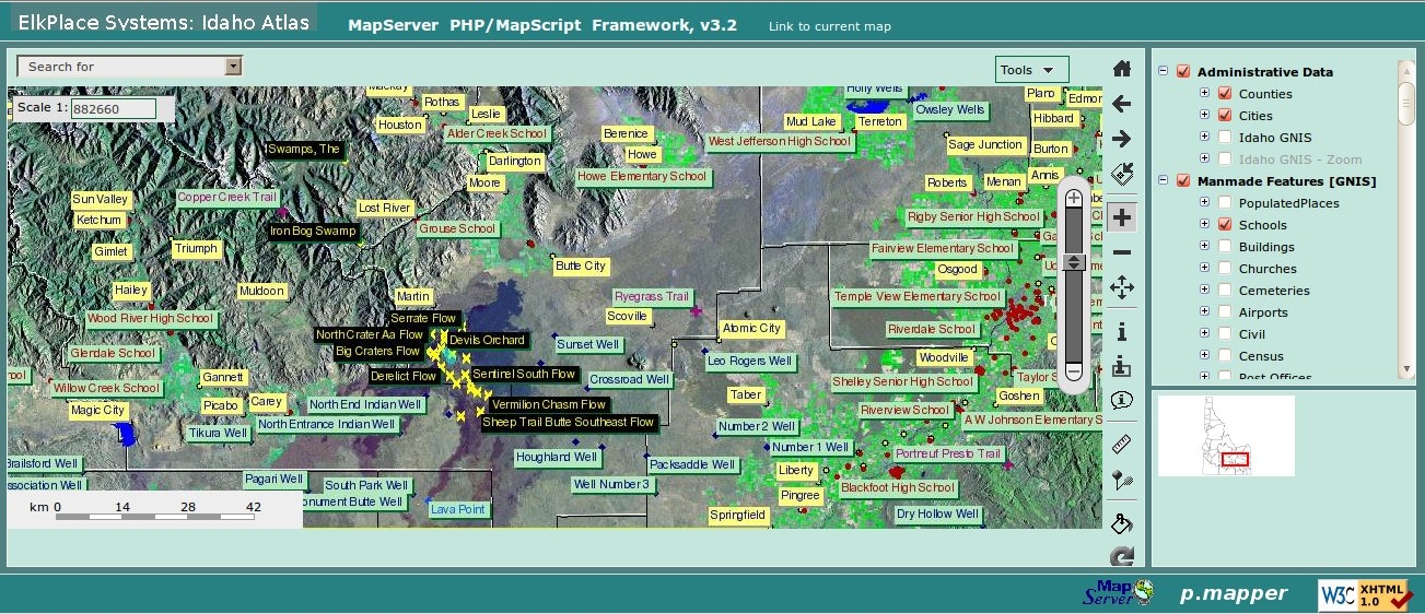
THE IDAHO ATLAS MAPSERVER: The Geographic Names
Information System (GNIS) 'gazetteer' information
has be referenced to a statwide Landsat Mosaic
(courtesy USGS), and additional vector data layers
for highways, major roads, local roads and rivers. If you should have questions on the MapServer application you are encouraged to contact the application developer (Don Schrupp) at 'hqwris@lamar.ColoState.EDU' as it was developed independently. An additional consideration to be aware of relative to this
mapping application: the USGS 'Geographic Information Names
System' (USGS/GNIS) was used in a 'gazateer' capacity to research
the geo-coordinates for the locations referenced in this application,
but they often reference a place on a USGS map where the 'Feature'
label was placed, and as such may not provide the 'real' coordinates
for the location referenced.
Enjoy!
|