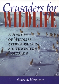
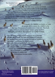
 In the year 2000, retired Colorado Division of Wildlife Information
Officer (and former District Wildlife Manager) Glen Hinshaw wrote his
tome 'Crusaders for Wildlife: a History of Wildlife Stewardship in
Southwestern Colorado'. It has taken some of us almost a decde to
'discover' this interesting read. I so enjoyed Glen's book, and all
the geographical 'references' that he provided, that I decided to
develop an internet 'MapServer' application that one could use to
'explore' all the locations in Colorado that Glen made reference to
in his book. All in all I found 1432 of these references to various
locales in Colorado. The 'MapServer' application has some built in
search capabilites, and both an 'overview' data layer ('Crusaders
for Wildlife') and Chapter by Chapter map layers (eg 'CH01'). The
mapping application also provides access to basemap reference
layers for Counties, Cities, Rivers, Highways, and a 'Digital
Elevation Model' (data layer) for Colorado. You're encouraged to
'Try It Out!' NOTE: You'll want to have a copy of Glen's book
by your side, as you explore the geography of Southwestern
Colorado that he portrays in his book. The book is published by
Western Reflections Publishing Company, and can be found by a
search on Author (Hinshaw) at westernreflectionspub.com .
In the year 2000, retired Colorado Division of Wildlife Information
Officer (and former District Wildlife Manager) Glen Hinshaw wrote his
tome 'Crusaders for Wildlife: a History of Wildlife Stewardship in
Southwestern Colorado'. It has taken some of us almost a decde to
'discover' this interesting read. I so enjoyed Glen's book, and all
the geographical 'references' that he provided, that I decided to
develop an internet 'MapServer' application that one could use to
'explore' all the locations in Colorado that Glen made reference to
in his book. All in all I found 1432 of these references to various
locales in Colorado. The 'MapServer' application has some built in
search capabilites, and both an 'overview' data layer ('Crusaders
for Wildlife') and Chapter by Chapter map layers (eg 'CH01'). The
mapping application also provides access to basemap reference
layers for Counties, Cities, Rivers, Highways, and a 'Digital
Elevation Model' (data layer) for Colorado. You're encouraged to
'Try It Out!' NOTE: You'll want to have a copy of Glen's book
by your side, as you explore the geography of Southwestern
Colorado that he portrays in his book. The book is published by
Western Reflections Publishing Company, and can be found by a
search on Author (Hinshaw) at westernreflectionspub.com .
 If you should have questions on the MapServer application you
are encouraged to contact the application developer (Don Schrupp)
at 'hqwris@lamar.ColoState.EDU' as it was developed independently
from Glen's initial book authorship. (Glen may be interested in
your questions too!) I have contacted Glen before going 'live'
to the world with this application. He and his publisher have been
so kind as to allow me to make this 'value added' supplement to his
writing effort publicly available.]
If you should have questions on the MapServer application you
are encouraged to contact the application developer (Don Schrupp)
at 'hqwris@lamar.ColoState.EDU' as it was developed independently
from Glen's initial book authorship. (Glen may be interested in
your questions too!) I have contacted Glen before going 'live'
to the world with this application. He and his publisher have been
so kind as to allow me to make this 'value added' supplement to his
writing effort publicly available.]
Some additional considerations to be aware of relative to this
mapping application: a) the USGS 'Geographic Information Names
System' (USGS/GNIS) was used in a 'gazateer' capacity to research
the geo-coordinates for the locations referenced in Glen's book;
but they often reference a place on a USGS map where the 'Feature'
label was placed, and as such may not provide the 'real' coordinates
for the location referenced, b) many locations (as you'll find out)
are 'repeatedly' referenced throughout the book, and c) there were a
number of 'local' places Glen talks about (eg 'La Garita Ranch'
and 'Cottonwood Cove') that I couldn't find geo-coordinates for,
through the GNIS data set. I hope to be in contact with Glen to
see if we can come up with coordinates for these areas.
Enjoy!
|
The base data are standard data layers assembled from the
United States Geological Survey's DLG and DRG data sets, data
sets from the Colorado Department of Transportation (CDOT)
and hydrography files from the Colorado Division of Wildlife
(CDOW). Geo-coordinates for locations cited in Glen Hinshaw's
book were 'researched' using the USGS 'Geographic Names
Information System' (as loaded to a web-based 'look-up'
program).
|
|
|
